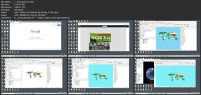
Introduction To Qgis For Remote Sensing
Published 10/2022
MP4 | Video: h264, 1280x720 | Audio: AAC, 44.1 KHz
Language: English | Size: 1.48 GB | Duration: 2h 19m
Learn the basics of creating a great map in QGIS
What you'll learn
Installation of QGIS software
Everything required to know about vector data
Processing vector data in QGIS
Everything required to know about raster data
Processing raster data in QGIS
Introduction to remote sensing techniques
Map layout design
Requirements
Having a computer with internet connection
Ability to install new software on the computer
Some knowledge of geographical information system theory
No prior knowledge of GIS software
Description
This course will teach you the basics of QGIS, starting with installing the software, importing data, and adapting the map settings and map format, to ensure you have a full vision of the features and capabilities of this software.QGIS is a professional GIS application that is built on top of and proud to be itself Free and Open Source Software (FOSS).QGIS is a user-friendly Open Source Geographic Information System (GIS) licensed under the GNU General Public License. QGIS is an official project of the Open Source Geospatial Foundation (OSGeo). It runs on Linux, Unix, Mac OSX, Windows, and Android and supports numerous vector, raster, and database formats and functionalities.QGIS is a volunteer-driven project. They welcome contributions in the form of code contributions, bug fixes, bug reports, contributed documentation, and advocacy.QGIS provides a continuously growing number of capabilities provided by core functions and plugins. You can visualize, manage, edit, analyze data, and compose printable maps.Start your software journey with us, edit data, create your desired map and impress others with your result!We love sharing our knowledge with the world and would like to say that we look forward to receiving all of your questions and feedback!
Overview
Section 1: Introduction
Lecture 1 Introduction
Lecture 2 Video 2 Vector Data Part 1
Lecture 3 Video 3 Vector Data Part 2.
Lecture 4 Video 4 Raster Data Part 1
Lecture 5 Video 5 Raster Data Part 2
Lecture 6 Video 6 Remote Sensing Part 1
Lecture 7 Video 7 Remote Sensing Part 2
Lecture 8 Video 8 Layout
Lecture 9 Video 9 File Types
Lecture 10 Video 10 Additional GIS Features
Begginers in Geographical Information systems and science,Natural science professionals,Digital knowledge seekers,Map makers amateurs,Social science professionals,Remote sensing professionals
Download link
rapidgator.net:
uploadgig.com:Kod:https://rapidgator.net/file/d4f7c86aa21273d2eaf350aafb245be4/renhm.Introduction.To.Qgis.For.Remote.Sensing.part1.rar.html https://rapidgator.net/file/a74a0a6c3b21c21d08cfa89ee24572a9/renhm.Introduction.To.Qgis.For.Remote.Sensing.part2.rar.html
nitroflare.com:Kod:https://uploadgig.com/file/download/57Ec365e2EA4bb4f/renhm.Introduction.To.Qgis.For.Remote.Sensing.part1.rar https://uploadgig.com/file/download/2935baBad5aedA0b/renhm.Introduction.To.Qgis.For.Remote.Sensing.part2.rar
1dl.net:Kod:https://nitroflare.com/view/59CB1A17621C5B7/renhm.Introduction.To.Qgis.For.Remote.Sensing.part1.rar https://nitroflare.com/view/221221D5ED46CE9/renhm.Introduction.To.Qgis.For.Remote.Sensing.part2.rar
Kod:https://1dl.net/0k614zgnx2ec/renhm.Introduction.To.Qgis.For.Remote.Sensing.part1.rar.html https://1dl.net/c9h0gudymp6k/renhm.Introduction.To.Qgis.For.Remote.Sensing.part2.rar.html
2 sonuçtan 1 ile 2 arası
-
11.10.2022 #1Üye


- Üyelik tarihi
- 20.08.2016
- Mesajlar
- 144.947
- Konular
- 0
- Bölümü
- Bilgisayar
- Cinsiyet
- Kadın
- Tecrübe Puanı
- 153
Introduction To Qgis For Remote Sensing
-
11.10.2022 #2Üye


- Üyelik tarihi
- 24.02.2022
- Yaş
- 41
- Mesajlar
- 19.748
- Konular
- 0
- Bölümü
- Matematik
- Cinsiyet
- Erkek
- Tecrübe Puanı
- 22
Cevap: Introduction To Qgis For Remote Sensing
[Misafirler Kayıt Olmadan Link Göremezler Lütfen Kayıt İçin Tıklayın ! ] Äúng thứ mình cần
ÄT 1294276340
Konu Bilgileri
Users Browsing this Thread
Şu an 1 kullanıcı var. (0 üye ve 1 konuk)


 LinkBack URL
 About LinkBacks


 Alıntı
Konuyu Favori Sayfanıza Ekleyin