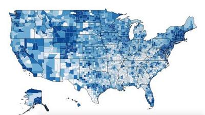
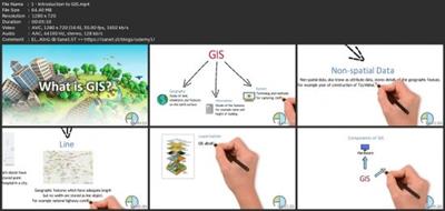
Mastering Geospatial Data Analysis And Mapping
Published 3/2023
MP4 | Video: h264, 1280x720 | Audio: AAC, 44.1 KHz
Language: English | Size: 5.43 GB | Duration: 10h 0m
Unlock the Power of Geospatial Data to Solve Real-World Problems
What you'll learn
An introduction to geospatial technology and its applications
The different types of geospatial data and their characteristics
How to work with coordinate systems, projections, and transformations
GIS data sources and data management techniques
Spatial analysis tools and techniques
Web GIS architecture and implementation
Remote sensing fundamentals and image processing techniques
Geospatial applications in environment, urban planning, and disaster management
Ethical and legal issues related to geospatial technology
Emerging trends and technologies in geospatial technology.
Requirements
A computer or mobile device with a stable internet connection
Familiarity with operating systems such as Windows or Mac OS
Basic knowledge of geographic concepts such as maps, coordinates, and spatial relationships
Familiarity with spreadsheet software such as Microsoft Excel or Google Sheets
Access to software tools such as ArcGIS, QGIS, or other GIS software (optional, but recommended)
Description
Geospatial technology is a rapidly expanding field that is essential in many sectors, including environmental science, urban planning, disaster management, and business analytics. As data-driven decision-making becomes more common in these fields, the ability to analyze and visualize data in a geographic context has become crucial.This course is designed to provide students with an in-depth understanding of Geospatial technology and its applications. Students will start with the fundamentals of coordinate systems, projections, and GIS data management techniques. They will learn how to manage, manipulate, and analyze geospatial data using GIS software. Through hands-on exercises, students will explore the various spatial analysis tools and techniques available, including spatial queries, geoprocessing, and spatial statistics.The course also covers the basics of remote sensing, including how to acquire, process, and analyze satellite imagery. Students will learn how to extract meaningful information from remote sensing data, such as land cover, vegetation health, and urbanization patterns. They will also learn how to use popular software tools like Google Earth Engine to conduct their analyses and interpret the results.In addition to these technical skills, the course covers the basics of web GIS, including how to create interactive web maps and geospatial applications. With web GIS becoming an increasingly important tool for sharing and communicating geospatial data, this course will provide students with a solid foundation for creating their own web-based geospatial applications.Furthermore, the course examines a range of geospatial applications in environmental science, urban planning, and disaster management. Students will learn about the latest technologies being used to solve real-world problems, such as tracking deforestation, monitoring water resources, predicting natural disasters, and managing emergency response.Through a series of practical exercises and real-world examples, students will gain the skills and knowledge they need to use Geospatial technology to its full potential. Whether they are data analysts, GIS professionals, or simply interested in the field of Geospatial technology, this course will provide them with the expertise and knowledge they need to succeed.By the end of the course, students will have a comprehensive understanding of Geospatial technology and its applications. They will also have the skills and knowledge needed to use various software tools and techniques to analyze, visualize, and communicate geospatial data effectively. With the rising demand for Geospatial technology, this course will provide students with the competitive edge they need to thrive in their careers.
Overview
Section 1: Introduction to Geospatial Technology
Lecture 1 Introduction to GIS
Lecture 2 Applications of Geospatial Technology
Lecture 3 Geospatial Data Types
Section 2: Coordinate Systems and Projections
Lecture 4 Geographic Coordinate Systems
Lecture 5 Projected Coordinate Systems
Lecture 6 Map Projections
Lecture 7 Coordinate Transformations
Section 3: GIS Data Sources
Lecture 8 Spatial Data Acquisition and Sources
Lecture 9 Data Quality and Standards
Lecture 10 Formats and Good Practices
Section 4: GIS Data Management
Lecture 11 Database Design and Management
Lecture 12 Data Editing and Maintenance
Lecture 13 Data Preparation and Conversion
Section 5: Spatial Analysis
Lecture 14 Basic Analysis Tools
Lecture 15 Spatial Statistics and Analysis Techniques
Lecture 16 Geoprocessing and Spatial Analysis with GIS
Section 6: Web GIS
Lecture 17 Overview of Web GIS
Lecture 18 Web GIS Architecture
Lecture 19 Web GIS Implementation and Application
Section 7: Remote Sensing
Lecture 20 Remote Sensing Fundamentals
Lecture 21 Types of Remote Sensing Platforms
Lecture 22 Image Processing and Analysis
Section 8: Geospatial Applications
Lecture 23 Geospatial Applications in Environment
Lecture 24 Geospatial Applications in Urban Planning and Development
Lecture 25 Geospatial Applications in Disaster Management
Section 9: Geospatial Ethics and Legal Issues
Lecture 26 Data Ownership and Intellectual Property Rights
Lecture 27 Legal Regulations and Ethical Issues in Geospatial Technologies
Section 10: Geospatial Future and Emerging Trends
Lecture 28 Future of Geospatial Technology
Lecture 29 Privacy Concerns
Lecture 30 Emerging Trends and Technologies
Section 11: Final Test
Students or professionals in the fields of geography, environmental science, urban planning, and related disciplines,Data analysts and data scientists interested in working with spatial data,Government officials and policymakers involved in environmental and disaster management,Business professionals interested in using geospatial data to make better decisions,Anyone interested in learning about emerging trends and technologies in geospatial technology.
Download link
rapidgator.net:
uploadgig.com:Kod:https://rapidgator.net/file/946c4370f8f5ad0976ca677b738a006f/pwjgb.Mastering.Geospatial.Data.Analysis.And.Mapping.part1.rar.html https://rapidgator.net/file/b980accad9e9adb5923cdda262ab7899/pwjgb.Mastering.Geospatial.Data.Analysis.And.Mapping.part2.rar.html https://rapidgator.net/file/db1cbf87b8238e4f9afa61824ab93467/pwjgb.Mastering.Geospatial.Data.Analysis.And.Mapping.part3.rar.html https://rapidgator.net/file/e9a9915ac28ed38f119b0f787ea26adb/pwjgb.Mastering.Geospatial.Data.Analysis.And.Mapping.part4.rar.html https://rapidgator.net/file/e19617beed309aed1a4f24439f8d9a30/pwjgb.Mastering.Geospatial.Data.Analysis.And.Mapping.part5.rar.html https://rapidgator.net/file/09ec1a1396627ac6fbf407b28c601c1a/pwjgb.Mastering.Geospatial.Data.Analysis.And.Mapping.part6.rar.html
nitroflare.com:Kod:https://uploadgig.com/file/download/185d066815e39ef1/pwjgb.Mastering.Geospatial.Data.Analysis.And.Mapping.part1.rar https://uploadgig.com/file/download/8dF531f1c1e381fF/pwjgb.Mastering.Geospatial.Data.Analysis.And.Mapping.part2.rar https://uploadgig.com/file/download/6299249db9873d5f/pwjgb.Mastering.Geospatial.Data.Analysis.And.Mapping.part3.rar https://uploadgig.com/file/download/B6f2f4B6d2c62c7c/pwjgb.Mastering.Geospatial.Data.Analysis.And.Mapping.part4.rar https://uploadgig.com/file/download/31516c87D2F169fb/pwjgb.Mastering.Geospatial.Data.Analysis.And.Mapping.part5.rar https://uploadgig.com/file/download/E0F46cF96e316d00/pwjgb.Mastering.Geospatial.Data.Analysis.And.Mapping.part6.rar
Kod:https://nitroflare.com/view/CE74690126B0EEA/pwjgb.Mastering.Geospatial.Data.Analysis.And.Mapping.part1.rar https://nitroflare.com/view/E512FBA81516A97/pwjgb.Mastering.Geospatial.Data.Analysis.And.Mapping.part2.rar https://nitroflare.com/view/B92FCD9C4A8C821/pwjgb.Mastering.Geospatial.Data.Analysis.And.Mapping.part3.rar https://nitroflare.com/view/A38ADF74A5558BF/pwjgb.Mastering.Geospatial.Data.Analysis.And.Mapping.part4.rar https://nitroflare.com/view/0084CD4387A0746/pwjgb.Mastering.Geospatial.Data.Analysis.And.Mapping.part5.rar https://nitroflare.com/view/E15704D38D4603E/pwjgb.Mastering.Geospatial.Data.Analysis.And.Mapping.part6.rar
1 sonuçtan 1 ile 1 arası
-
06.03.2023 #1Üye


- Üyelik tarihi
- 20.08.2016
- Mesajlar
- 144.947
- Konular
- 0
- Bölümü
- Bilgisayar
- Cinsiyet
- Kadın
- Tecrübe Puanı
- 153
Mastering Geospatial Data Analysis And Mapping
Konu Bilgileri
Users Browsing this Thread
Şu an 1 kullanıcı var. (0 üye ve 1 konuk)


 LinkBack URL
 About LinkBacks


 Alıntı
Konuyu Favori Sayfanıza Ekleyin