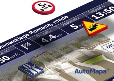
AutoMapa 6.18 1509 EU
AutoMapa 6.18 1509 EU | 3.5 Gb
Aqurat sp. z o.o. and Geosystems sp. z o.o has released 6.18 version AutoMapa EU is a detailed navigation map of whole Europe. AutoMapa is the first satellite navigation system to feature 3D building visualisation in Polish and European towns and cities, making it the world's leading car navigation utility.
Owing to its coverage of a comprehensive road network in Poland and the unique building address option, AutoMapa delivers unprecedented navigation precision on Polish and European roads.
Highly accurate city navigation maps, hundreds of thousands of precisely described Points of Interest (POI), a unique community of registered users of the Miplo.pl service and Krzysztof Hołowczyc's voice - those are the distinctive features of AutoMapa.
AutoMapa is a leader on the market of innovative solutions. It is the first Polish system that supports the collection of traffic data, and users will soon be able to avoid traffic jams with the program's help.
AutoMapa Europe
AutoMapa Europe is a detailed navigation map of whole Europe. It includes full version of Polska XL map, extended by navigation data of European countries provided by the Navteq company.
Searching for travel destinations and navigation all over Europe does not require switching between maps- they are combined into one homogenous product with advantages of the most detailed maps of Polska XL release and maps of Europe of the Navteq company. Information on the degree of precision and the area covered in respective countries are presented on page 'Contents'.
Just like Polska XL map, AutoMapa Europe release also offers the option of choosing and installing both a selected part and the whole map. Thus the user depending on his/her needs may have at his/her disposal either a set of maps for navigation or, when needed (i.e. when the map is to be stored on a small memory card) only a selected area.
AutoMapa Europe on the territory of Poland offers all functionalities of AutoMapa Polska XL, including detailed address points, visualisations of building outlines, rich topographic contents and many others. Detailed address points and building outlines is a unique feature available only in AutoMapa navigation system.
AutoMapa is a co-product by two companies: Aqurat sp. z o.o. and Geosystems sp. z o.o
About Aqurat sp. z o.o.
The company specializes in advanced processing systems and visualization of information. Offers. navigation system for drivers and tourists, AutoMapa, dedicated monitoring systems and fleet management and intelligent technology for the interpretation of the queries.
About Geosystems sp. z o.o
GEOSYSTEMS Polska Ltd. is remote sensing/photogrammetry and LIS/GIS consultancy and laboratory involved in various types of geographic data processing, spatial analysis and geovisualisation.
Name: AutoMapa EU
Software version : 6.18.0.2611
Map version: 1509.6.783 EU
Interface: multilanguage
Сoverage: all Europe
System Requirements: ShiChuang Mobile 5/6, ShiChuang CE.NET 5.0/6.0, ShiChuang XP / Vista / Seven / 8
Size: 3.5 Gb
Home:
[Misafirler Kayıt Olmadan Link Göremezler Lütfen Kayıt İçin Tıklayın ! ]
[Misafirler Kayıt Olmadan Link Göremezler Lütfen Kayıt İçin Tıklayın ! ]
[Misafirler Kayıt Olmadan Link Göremezler Lütfen Kayıt İçin Tıklayın ! ]
[Misafirler Kayıt Olmadan Link Göremezler Lütfen Kayıt İçin Tıklayın ! ]
[Misafirler Kayıt Olmadan Link Göremezler Lütfen Kayıt İçin Tıklayın ! ]
[Misafirler Kayıt Olmadan Link Göremezler Lütfen Kayıt İçin Tıklayın ! ]
[Misafirler Kayıt Olmadan Link Göremezler Lütfen Kayıt İçin Tıklayın ! ]
[Misafirler Kayıt Olmadan Link Göremezler Lütfen Kayıt İçin Tıklayın ! ]
[Misafirler Kayıt Olmadan Link Göremezler Lütfen Kayıt İçin Tıklayın ! ]
[Misafirler Kayıt Olmadan Link Göremezler Lütfen Kayıt İçin Tıklayın ! ]
[Misafirler Kayıt Olmadan Link Göremezler Lütfen Kayıt İçin Tıklayın ! ]
[Misafirler Kayıt Olmadan Link Göremezler Lütfen Kayıt İçin Tıklayın ! ]
1 sonuçtan 1 ile 1 arası
Konu: AutoMapa 6.18 1509 E...
-
23.09.2016 #1Üye


- Üyelik tarihi
- 20.08.2013
- Mesajlar
- 155.922
- Konular
- 0
- Bölümü
- Elektronik
- Cinsiyet
- Kadın
- Tecrübe Puanı
- 167
AutoMapa 6.18 1509 E...
Konu Bilgileri
Users Browsing this Thread
Şu an 1 kullanıcı var. (0 üye ve 1 konuk)


 LinkBack URL
 About LinkBacks


 Alıntı
Konuyu Favori Sayfanıza Ekleyin